- +86 18825289328
- support@hiwonder.com
No result found for your search.
Your cart is empty
- Home
- Sensor
- GPS Beidou Positioning Module BD Dual-Mode Satellite Navigation IMU Inertial Navigation Sensor for ROS1/ROS2 Robot GPS Beidou Positioning Module BD Dual-Mode Satellite Navigation IMU Inertial Navigation Sensor for ROS1/ROS2 Robot


Features
Videos
Options
Fast Delivery
Technical Support
Tutorials Provided
To know which one is right for you, ask our specialist.
Hiwonder
GPS Beidou Positioning Module BD Dual-Mode Satellite Navigation IMU Inertial Navigation Sensor for ROS1/ROS2 Robot
Product SKU: 21090107
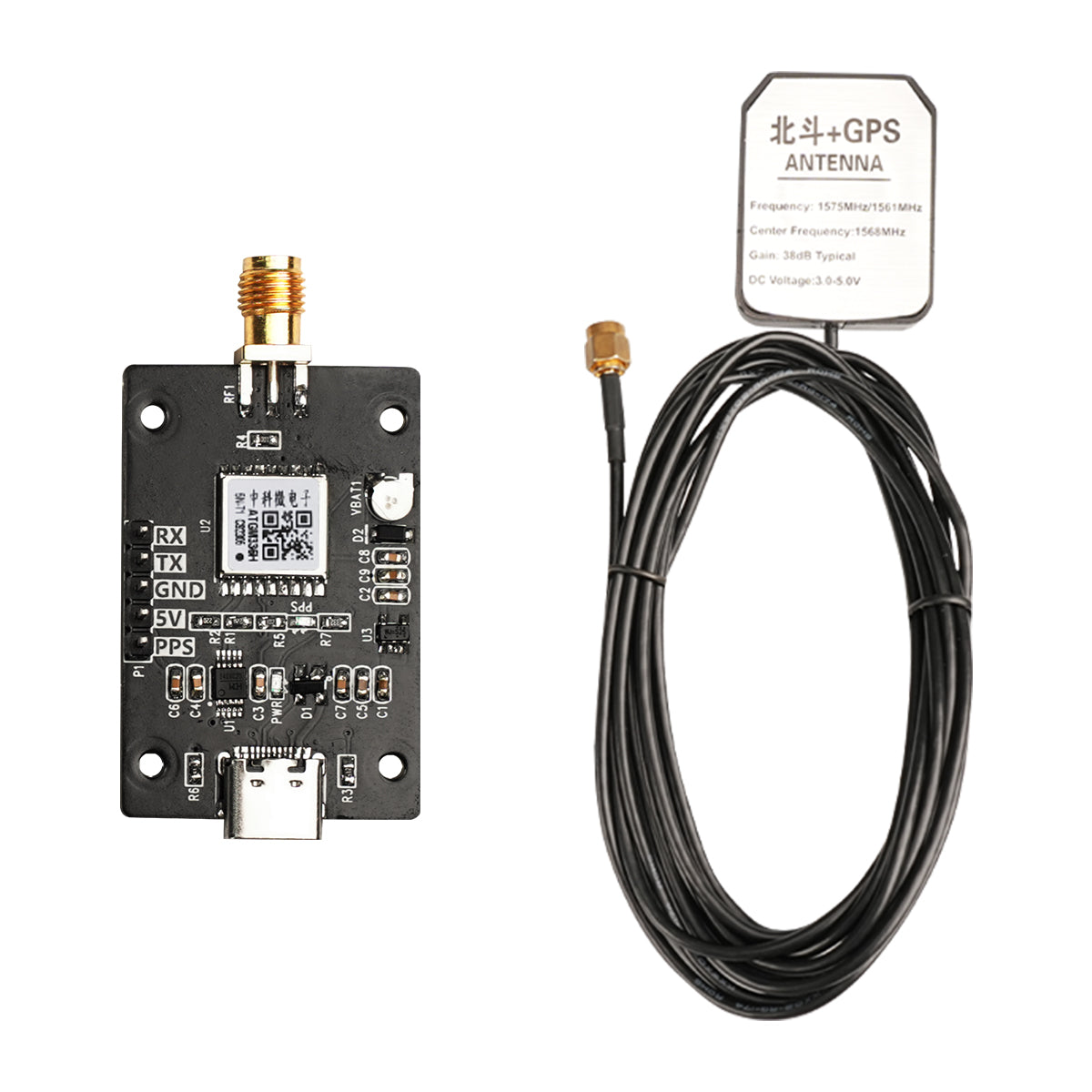
- 【High-performance】Hiwonder's GPS module is a high- performance GNSS positioning and navigation module based on ATGM336H-5N, offering positioning accuracy of < 2.5 meters. It has the advantages of Small size, low cost, high sensitivity, low power consumption and user-friendly operation.
- 【Supports intergrated positioning, navigation and timing functions】This module supports Beidou-2 and Beidou-3 (B11and B1C), GALILEO, GPS/QZSS/SBAS, GLONASS, and other satellite navigation systems. In addition, it can simultaneously receive signals from multiple satellite navigation systems, enabling integrated positioning,navigation,and timing functions.
- 【Provide rich tutorial materials】Hiwonder provides a wealth of tutorial materials, such as PC software, operating instructions, development manuals, development codes, etc.
Available:
Only 992 items in stock
In stock
In stock
Out of stock
Back in stock
Price:
$30.00
Save
% $-30.00
- Description
- Specifications
- Accessories
Product Description
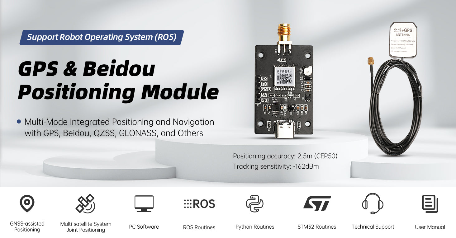
Hiwonder's GPS module is a high-performance GNSS positioning and navigation module based on ATGM336H-5N, offering positioning accuracy of < 2.5 meters. With features such as a compact size, cost-effectiveness, high sensitivity, and user-friendly design, this module supports Beidou-2 and Beidou-3 (B11 and B1C), GALILEO, GPS/QZSS/SBAS, GLONASS, and other satellite navigation systems. In addition, it can simultaneously receive signals from multiple satellite navigation systems, enabling integrated positioning, navigation, and timing functions.
Beyond its impressive performance and low power consumption, the GPS module is well-suited for applications requiring high-precision positioning and timing. Its versatility extends to various fields, including but not limited to vehicle navigation, handheld positioning, and DIY projects for wearable devices. Whether the requirement is for high-precision positioning or accurate timing, Hiwonder's GPS module stands as a reliable solution.

Multi-satellite Navigation System Integration
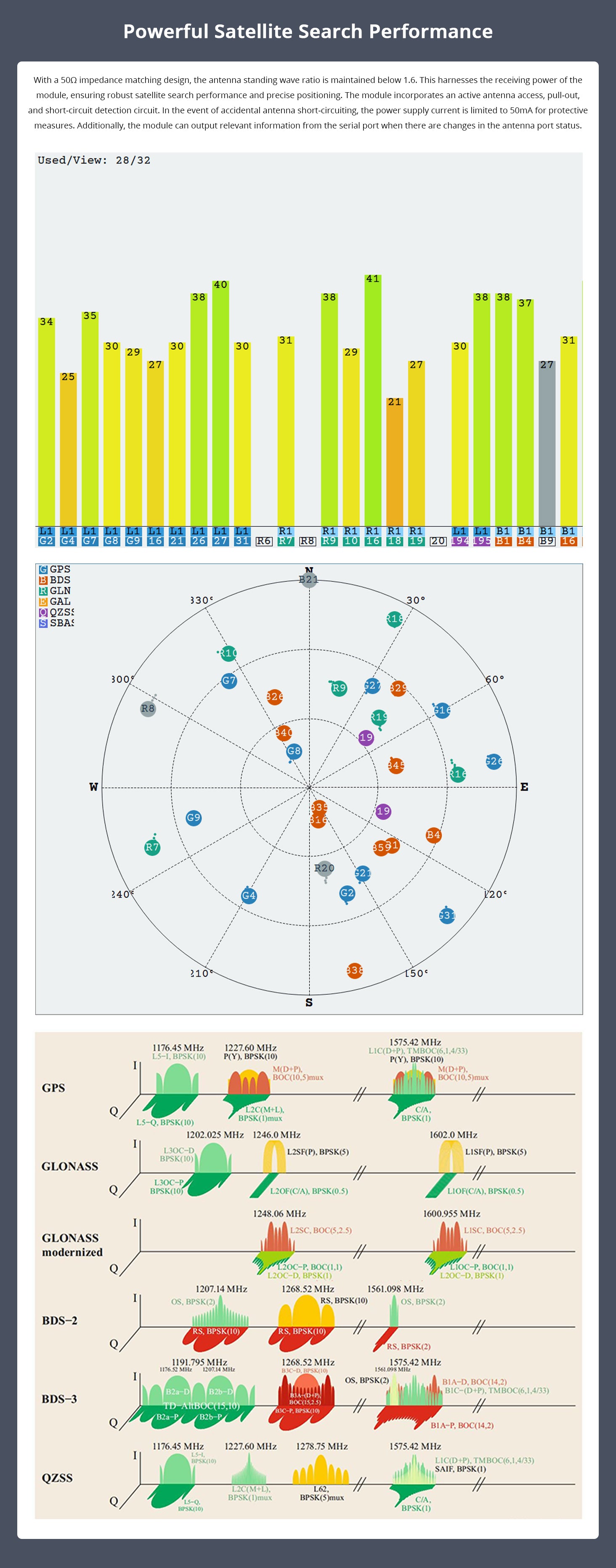
With high sensitivity and 32 channels, this module supports single-system positioning for the BDS/GPS/QZSS/GLONASS satellite navigation system. Additionally, it offers the capability for joint positioning with any combination of multiple navigation systems.
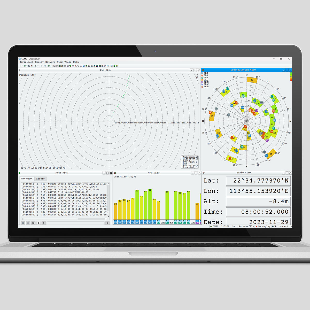
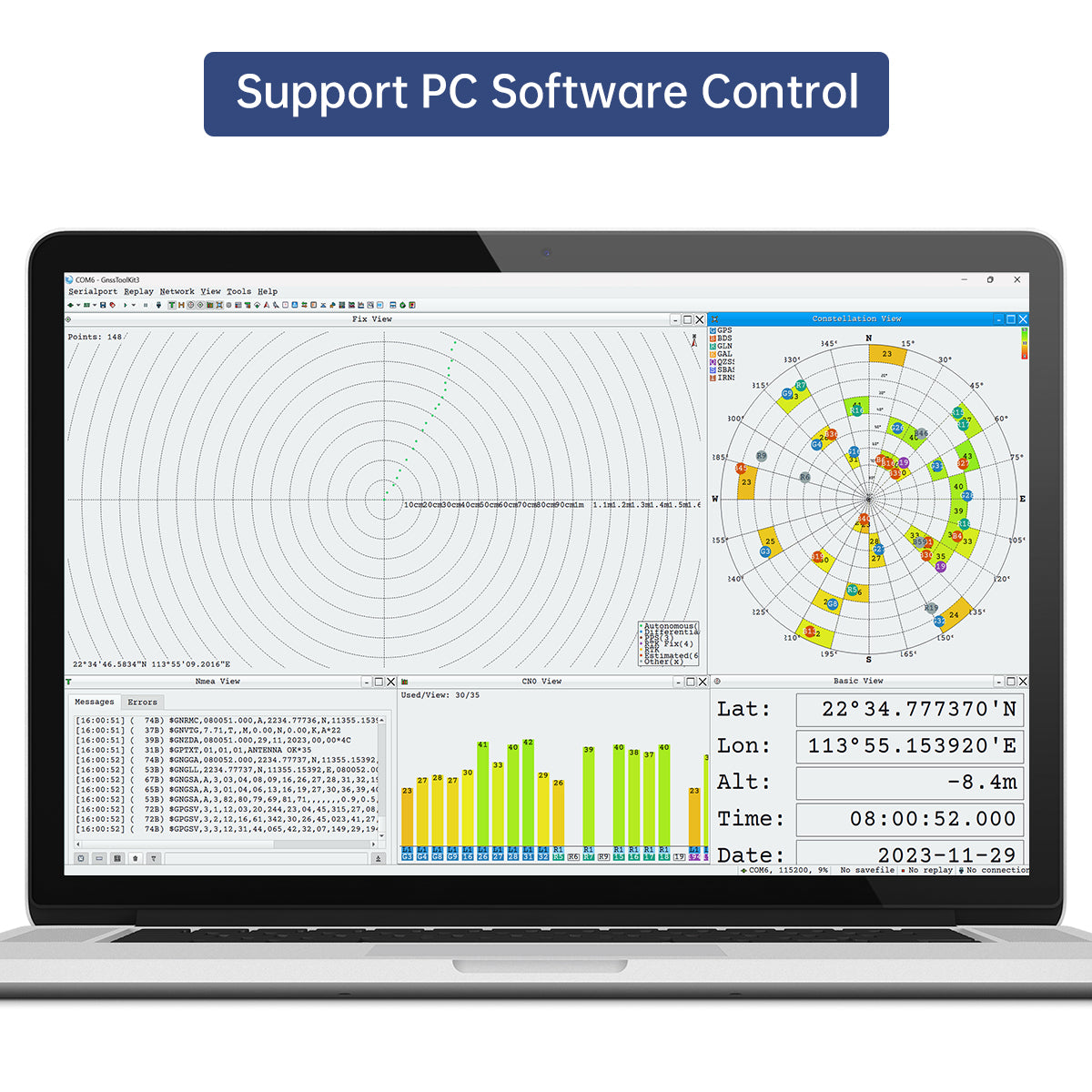
Support PC Software Control
The GPS module supports PC software control and supports Windows systems. The PC software can display latitude, longitude, altitude, date and other related data.
Features
- ①Achieves high-precision GNSS positioning with accuracy less than 2.5 meters.
- ②Have the ability to simultaneously receive signals from the above satellite navigation systems to achieve joint positioning, navigation and timing functions.
- ③Small size, low cost, high sensitivity, low power consumption and user-friendly operation.
- ④Suitable for outdoor positioning navigation, maker DIY and other scenarios

| 10-Axis IMU Inertia Navigation Module Specification | |
| Model | Hiwonder 1M10A inertia navigation module |
| Axis number | 10-axis |
| Data output frequency | 10Hz by default. It can be adjusted within 0.2Hz - 200Hz |
| Serial communication port | The baud rate is default to 9600bps. It can be adjusted within 4800bps - 921600bps |
| Communication method | Support USB/ UART/ I2C communication |
| ROS support | ROS1/ ROS2 |
Key Features
Unified Positioning and Navigation with GPS, GLONASS, Beidou, and More
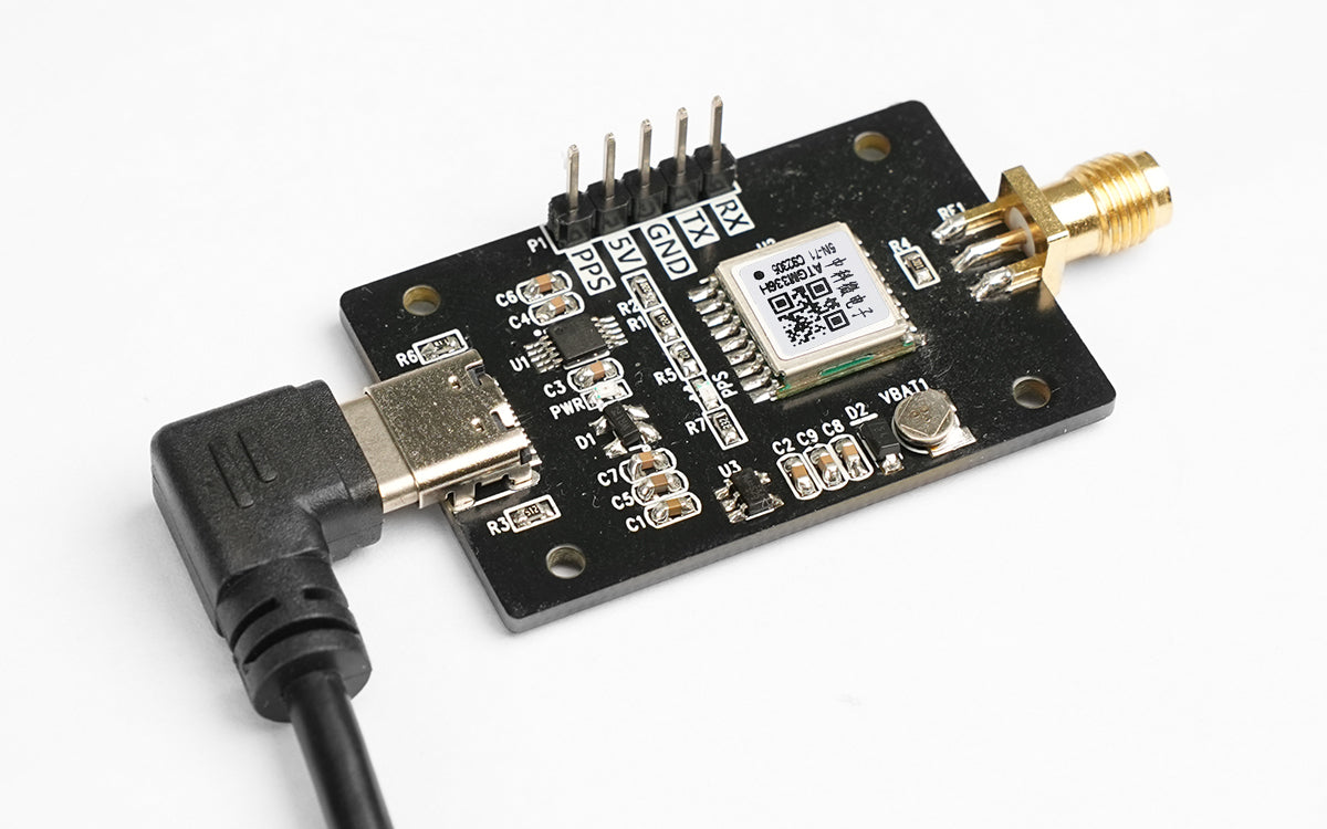
Low Power Consumption/ High Intensity/ Cost-effective
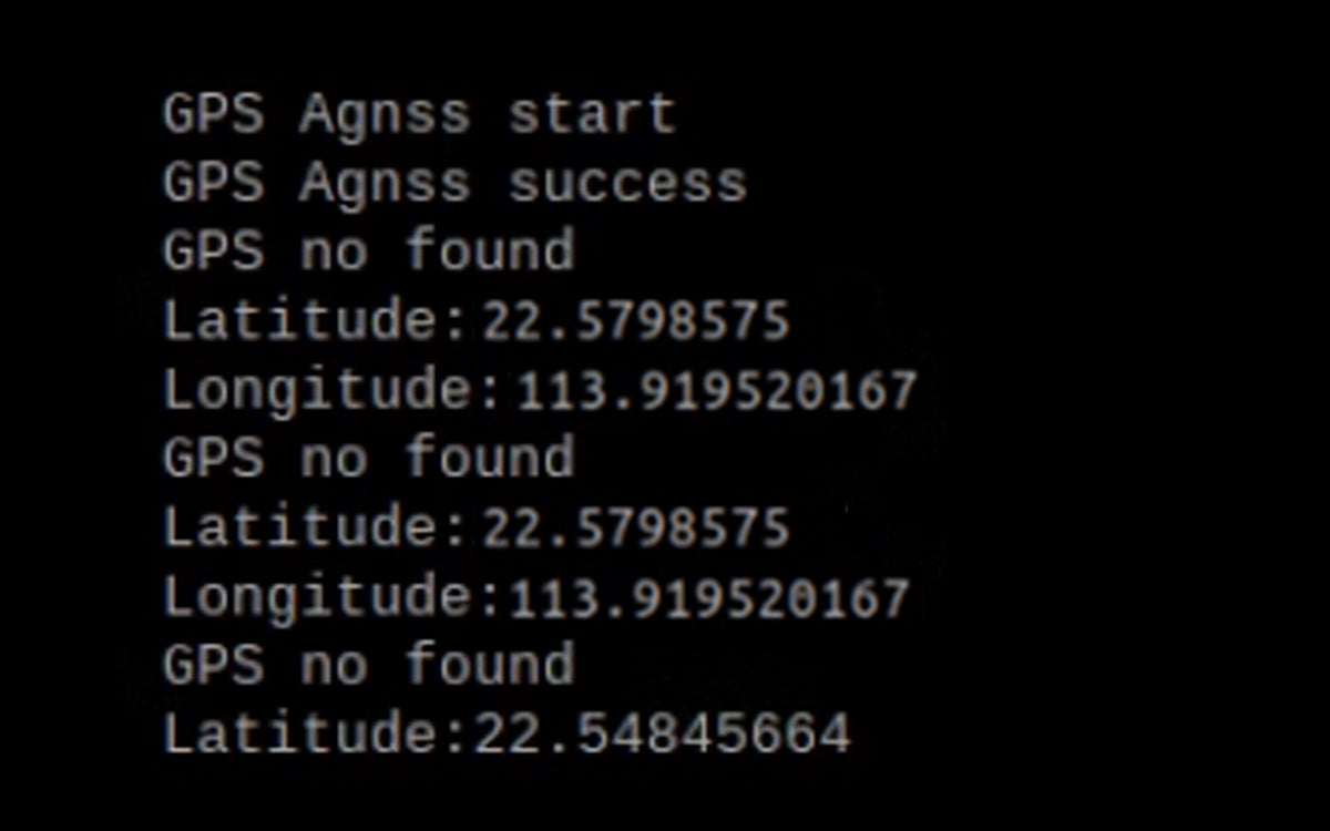
Support WiFi Positioning in Weak Signal Areas, and Rapid Satellite Signal Search Using agnss
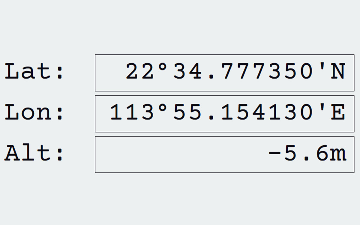
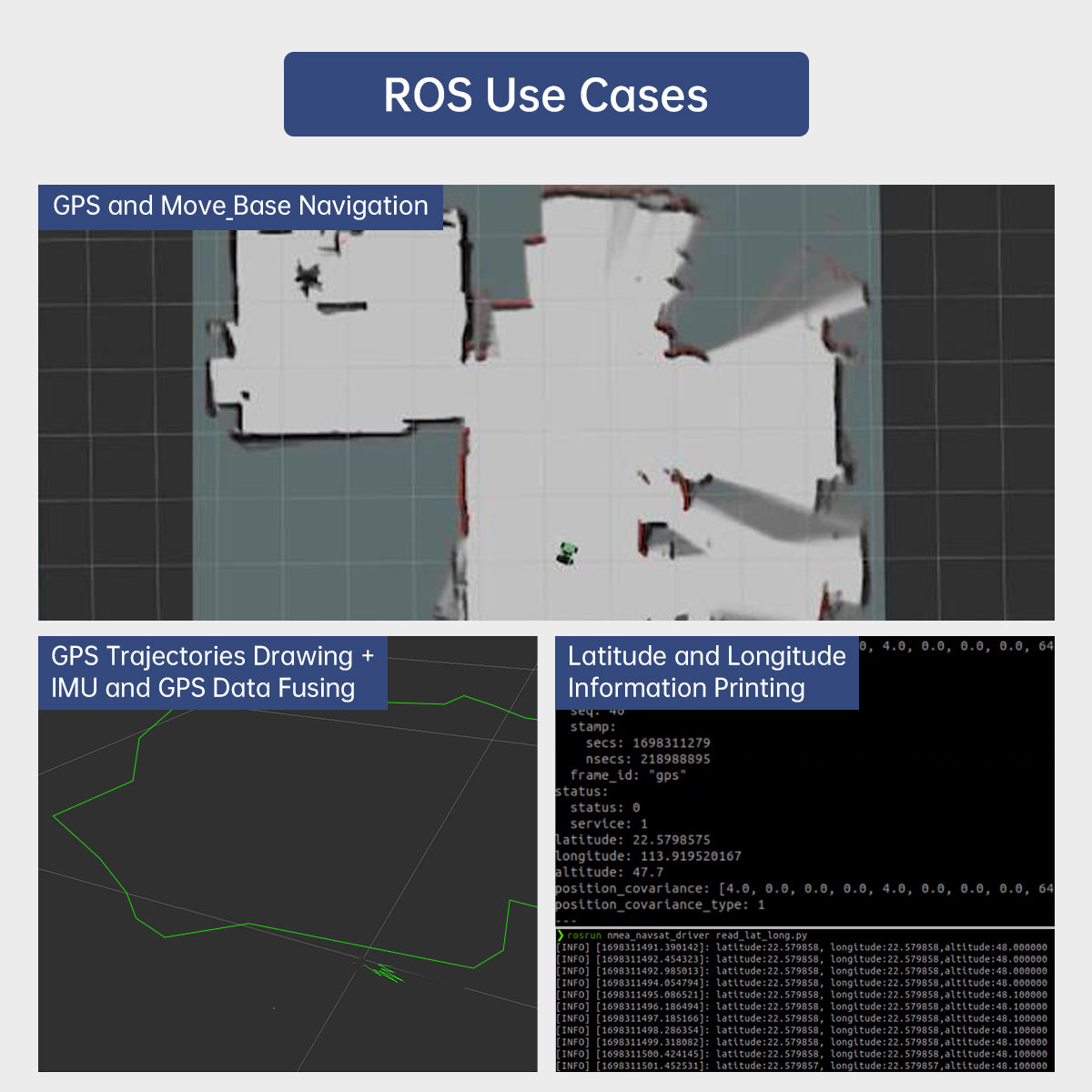
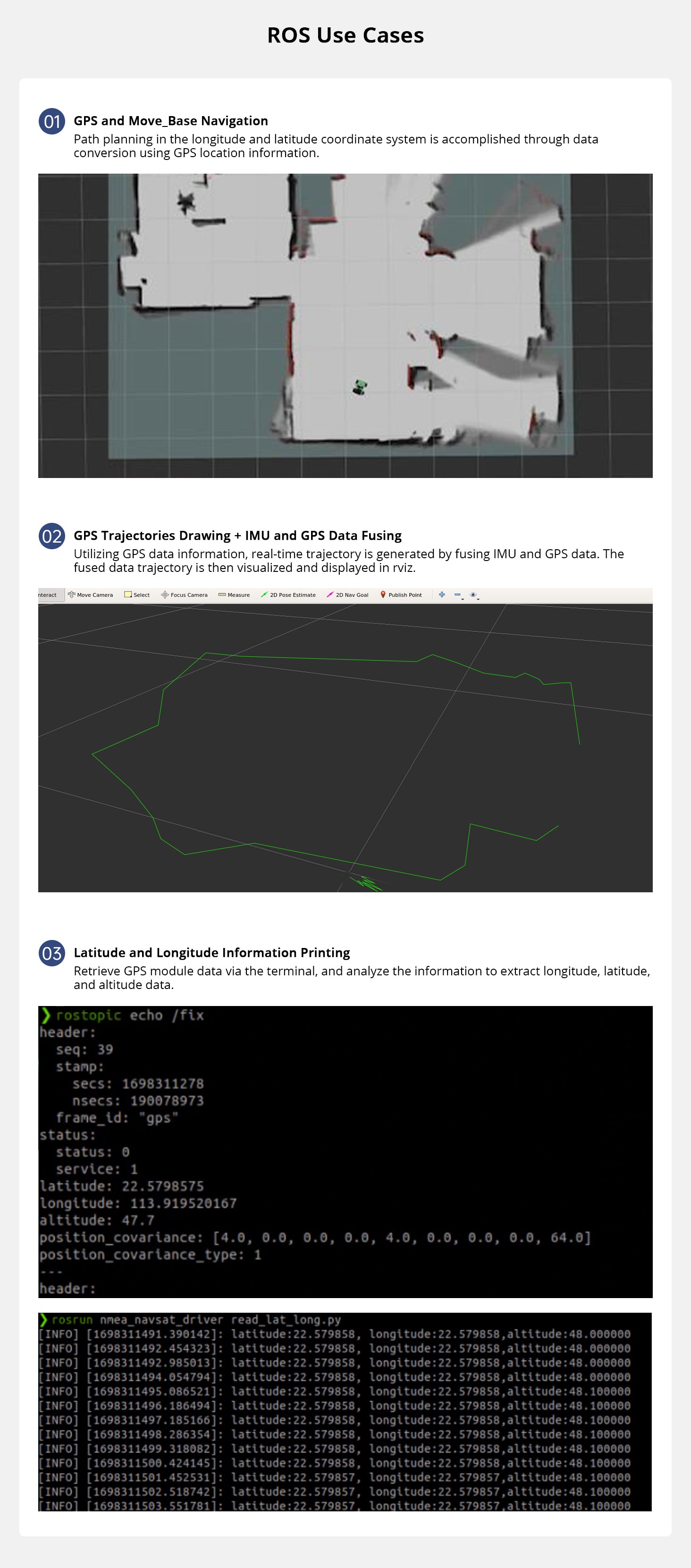
Longitude, Latitude and Altitude Retrieving
Retrieve longitude, latitude, and altitude through multi-satellite joint positioning.
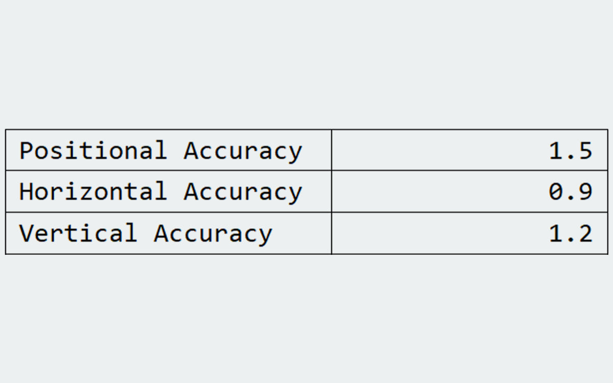
Position Accuracy
Output longitude, latitude and altitude accuracy.
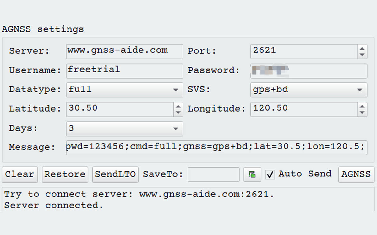
Assistance Positioning
AGBSS can retrieve data from the server to enhance startup speed.
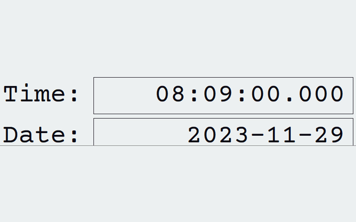
UTC Time
UTC time: acquire the current time and date from the satellite.
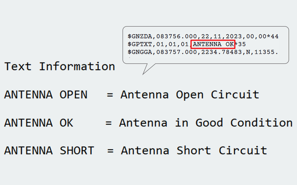
Antenna Detection
Verify the normal functioning of the antenna and check for any short circuits.
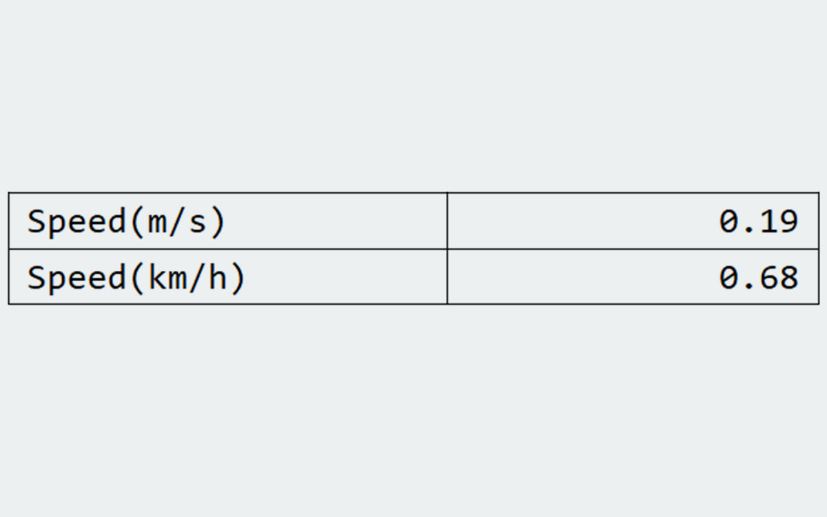
Speed Obtaining
Calculate the module's speed through internal processing.
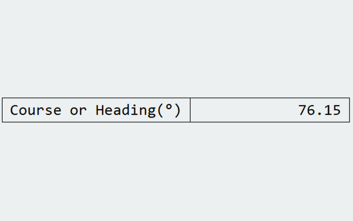
Heading Acquisition
Output ground speed and heading information using the satellite positioning module.

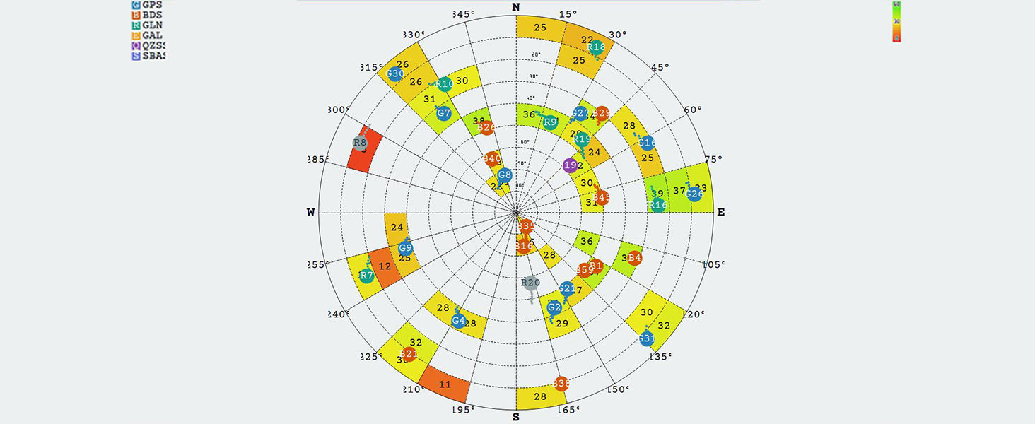
Satellite Information Retrieval
Output the number, position, and effectiveness of the connected satellites.
Product Parameters
| Technical parameters | |||
| Model | Icofchina ATGM336H-5N71 | Signal receiving | BDS/ GPS/ GLONASS/ GALILEO/ QZSS/ SBAS |
| RF Channel Count | Three RF channels, enabling simultaneous reception from all constellations, including BDS, GPS, and GLONASS | Serial port specification | Baud rate range: 4800bps-115200bps, default 9600bps, 8 data bits, no parity, 1 stop bit |
| Hot start TTFF | ≤1s | Recapture TTFF | ≤1s |
| Cold start capture sensitivity | -148dBm | Hot start capture sensitivity | -156dBm |
| Recapture sensitivity | -160dBm | Tracking sensitivity | -162dBm |
| Positioning accuracy | 20kg | Support | 2.5m (CEP50, open area) |
| Speed measurement accuracy | <0.1m/s (1σ) | Timing accuracy | <30ns (1σ) |
| Cold start TTFF | ≤35s | Position update frequency | 1Hz by default. Maximum frequency can reach 10Hz |
| Protocol | NMEA0183 | Maximum height | 18000m |
| Maximum speed | 515m/s | Maximum acceleration | 4g |
| Power supply | 3.3V - 5V | Storage temperature | -45℃ ~ +125℃ |
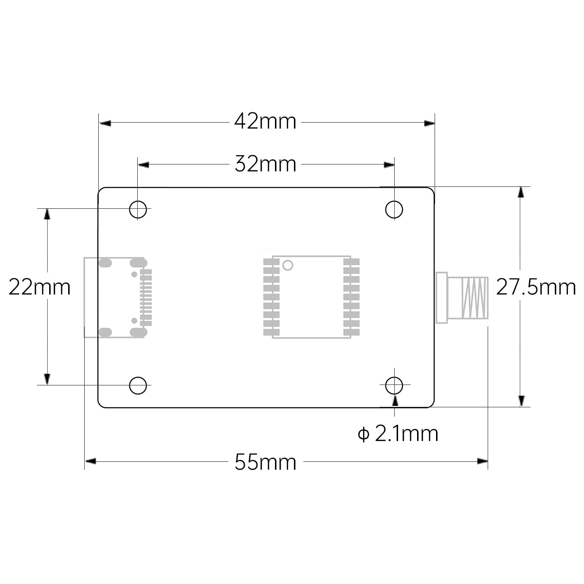
| BDS + GPS classic power consumption | <25mA @3.3V | Size | 55*27.5*11.3mm (with flat cable); 55*27.5*6.6 (without flat cable) |
| Operating temperature | -40℃ ~ +85℃ | Weight | 7.3g |
| Technical parameters | |||
| Model | Icofchina ATGM336H-5N71 | ||
| Signal receiving | BDS/ GPS/ GLONASS/ GALILEO/ QZSS/ SBAS | ||
| RF Channel Count | Three RF channels, enabling simultaneous reception from all constellations, including BDS, GPS, and GLONASS | ||
| Serial port specification | Baud rate range: 4800bps-115200bps, default 9600bps, 8 data bits, no parity, 1 stop bit | ||
| Hot start TTFF | ≤1s | ||
| Recapture TTFF | ≤1s | ||
| Cold start capture sensitivity | -148dBm | ||
| Hot start capture sensitivity | -156dBm | ||
| Recapture sensitivity | -160dBm | ||
| Tracking sensitivity | -162dBm | ||
| Positioning accuracy | 20kg | ||
| Support | 2.5m (CEP50, open area) | ||
| Speed measurement accuracy | <0.1m/s (1σ) | ||
| Timing accuracy | <30ns (1σ) | ||
| Cold start TTFF | ≤35s | ||
| Position update frequency | 1Hz by default. Maximum frequency can reach 10Hz | ||
| Protocol | NMEA0183 | ||
| Maximum height | 18000m | ||
| Maximum speed | 515m/s | ||
| Maximum acceleration | 4g | ||
| Power supply | 3.3V - 5V | ||
| Storage temperature | -45℃ ~ +125℃ | ||
| BDS + GPS classic power consumption | <25mA @3.3V | ||
| Size | 55*27.5*11.3mm (with flat cable); 55*27.5*6.6 (without flat cable) | ||
| Operating temperature | -40℃ ~ +85℃ | ||
| Weight | 7.3g | ||
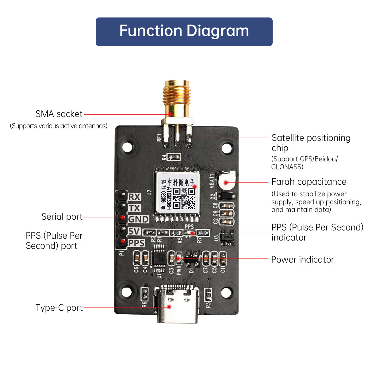
| Pin definition | ||
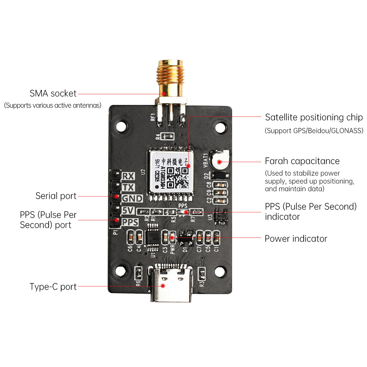
| 1 | 5V | DC5V power input |
| 2 | GND | Ground wire |
| 3 | TX | TX serial data input |
| 4 | RX | RX serial data input |
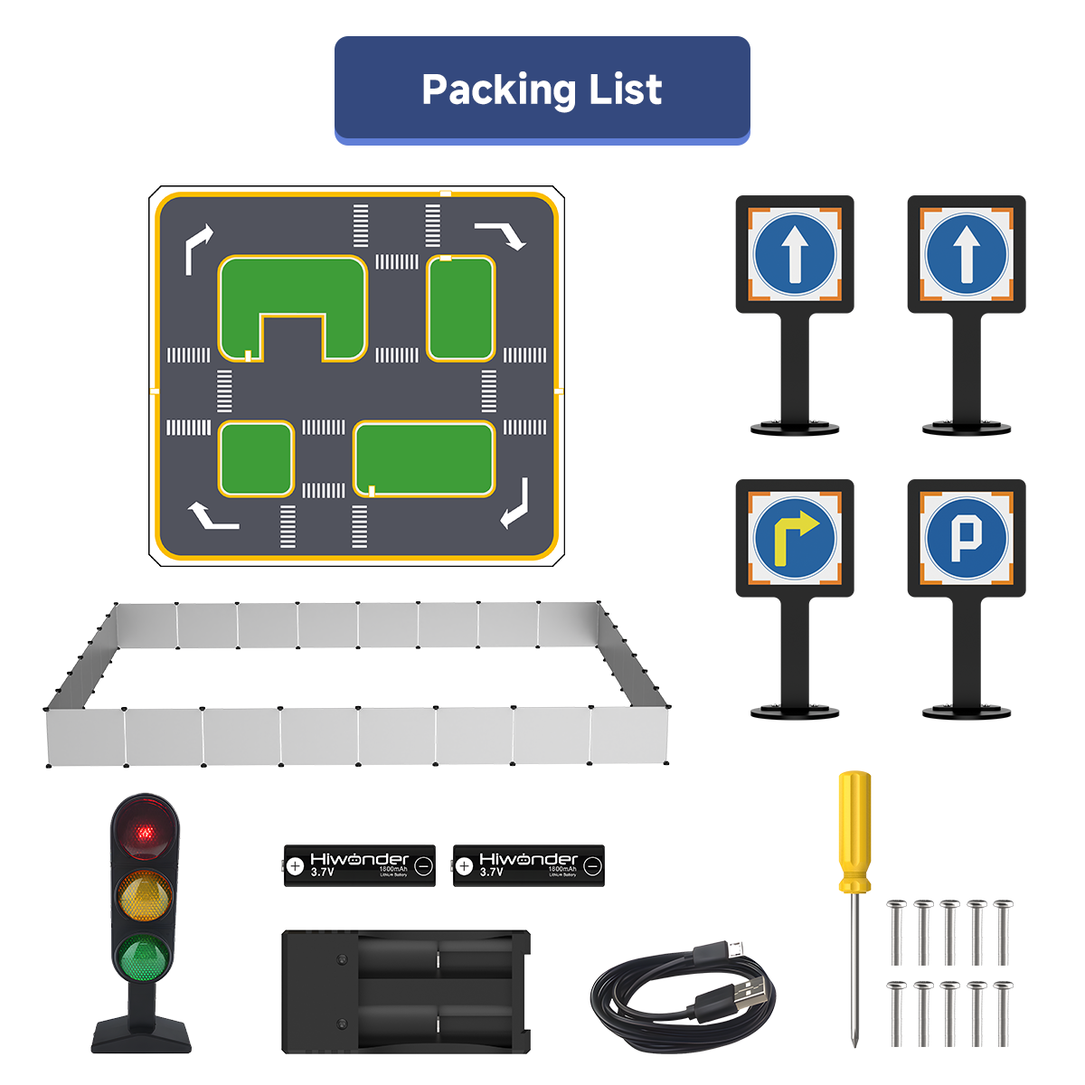
Packing List
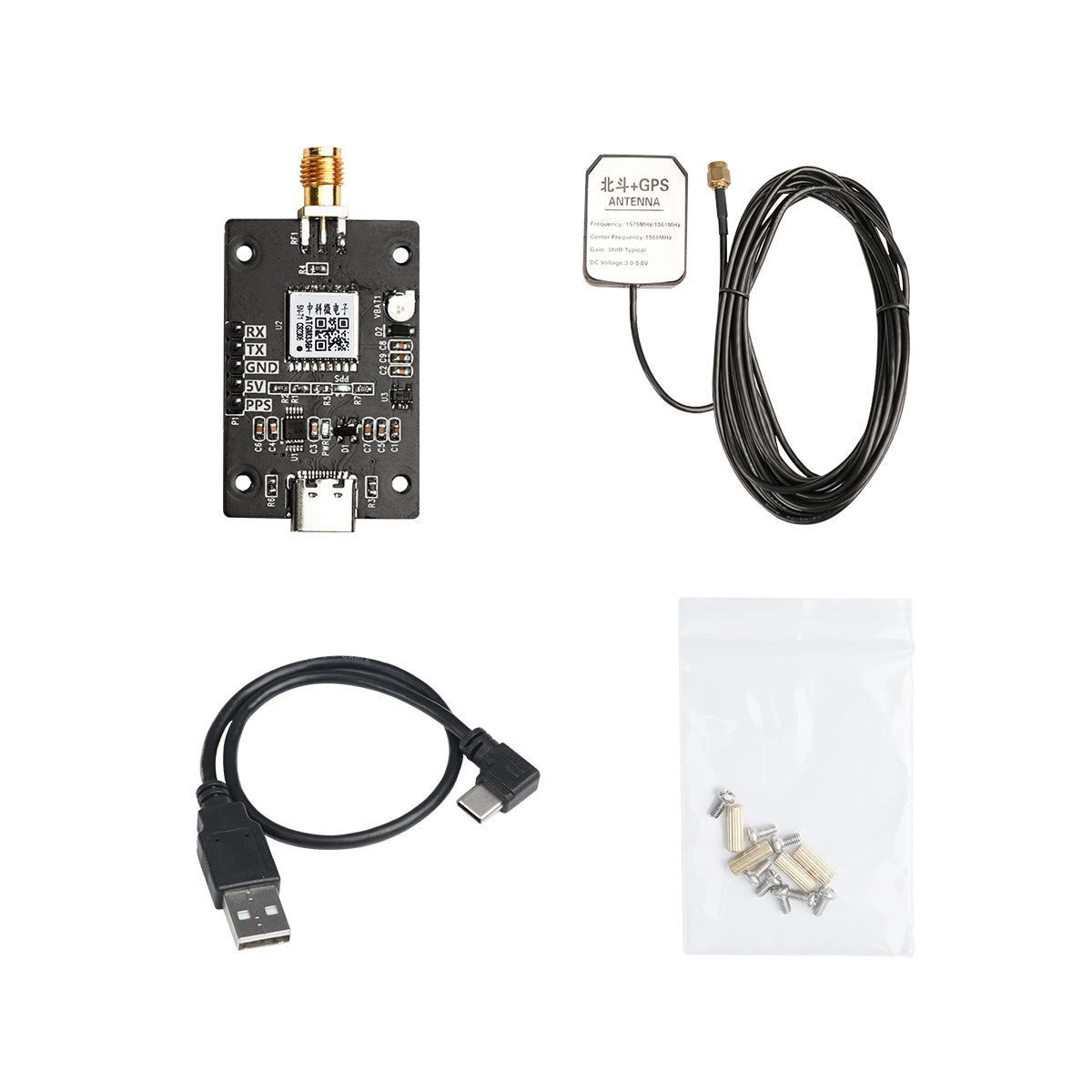
GPS&Beidou Positioning Module Kit

GPS&Beidou Positioning Module Kit +
10-Axis IMU Inertia Navigation Module Kit
10-Axis IMU Inertia Navigation Module Kit

GPS&Beidou Positioning Module Kit

GPS&Beidou Positioning Module Kit + 10-Axis IMU Inertia Navigation Module Kit

| Item | Specification |
| Model | Icofchina ATGM336H-5N71 |
| Signal receiving | BDS/ GPS/ GLONASS/ GALILEO/ QZSS/ SBAS |
| RF Channel Count | Three RF channels, enabling simultaneous reception from all constellations, including BDS, GPS, and GLONASS |
| Serial port specification | Baud rate range: 4800bps-115200bps, default 9600bps, 8 data bits, no parity, 1 stop bit |
| Hot start TTFF | ≤1s |
| Recapture TTFF | ≤1s |
| Cold start capture sensitivity | -148dBm |
| Hot start capture sensitivity | -156dBm |
| Recapture sensitivity | -160dBm |
| Tracking sensitivity | -162dBm |
| Positioning accuracy | 20kg |
| Support | 2.5m (CEP50, open area) |
| Speed measurement accuracy | <0.1m/s (1σ) |
| Timing accuracy | <30ns (1σ) |
| Cold start TTFF | ≤35s |
| Position update frequency | 1Hz by default. Maximum frequency can reach 10Hz |
| Protocol | NMEA0183 |
| Maximum height | 18000m |
| Maximum speed | 515m/s |
| Maximum acceleration | 4g |
| Power supply | 3.3V - 5V |
| Storage temperature | -45℃ ~ +125℃ |
| BDS + GPS classic power consumption | <25mA @3.3V |
| Size | 55*27.5*11.3mm (with flat cable); 55*27.5*6.6 (without flat cable) |
| Operating temperature | -40℃ ~ +85℃ |
| Weight | 7.3g |
D
DH K GPS Beidou Positioning Module BD Dual-Mode Satellite Navigation IMU Inertial Navigation Sensor for ROS1/ROS2 Robot


